Urban and rural settlement of the population of the Russian Federation. Features of the distribution of the population of Russia Forms of settlement and types of settlements
 Some countries are said to have “more land than people” within their borders. This statement fully applies to Russia. Our country is very sparsely populated.
 Uninhabited territory makes up more than half the area of Russia. At the same time, the European part is almost completely populated, not counting the Northern Economic Region, in which the population covers 2/3 of the territory. Eur o p tea y s st k a i
 94% of the uninhabited territory is located in the Asian part: less than 1/3 of the area is permanently inhabited there. The most sparsely populated is the Far Eastern economic region, where developed territories occupy only 1/5 of the total area and where more than half of all unpopulated territories of Russia are located. Asian part
 In Russia, historically, a main zone of settlement has developed. This strip is wide in the European part (from St. Petersburg to Rostov-on-Don) to the east it narrows and stretches along the Trans-Siberian Railway to Vladivostok.
 Features of the main settlement zone: Occupies about 1/3 of the country's territory, this strip concentrates more than 90% of the population.


 The focal settlement (in some places) of the Northern Zone is explained both by the severity of natural conditions and by economic reasons. People live near developed mineral deposits, in transport hubs, in areas of natural resource processing (Norilsk, Magadan, Murmansk, etc.), in the valleys of large rivers. Features of the North Zone

 Many areas of the Northern zone do not have a permanent population. The lack of population prevents the development of diverse and rich natural resources.

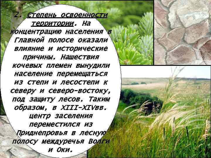 2. Degree of development of the territory. Historical reasons also influenced the concentration of population in the Main Belt. Invasions of nomadic tribes forced the population to move from the steppe and forest-steppe to the north and northeast, under the protection of forests. Thus, in the XIII-XIV centuries. the center of settlement moved from the Dnieper region to the forest belt between the Volga and Oka rivers.
 3. Economic reasons. Crafts and trade began to develop. In the Urals, the influx of population was largely explained by the development (starting from the 18th century) of mineral wealth. Then the settlement of Siberia by Russians and the construction of the Trans-Siberian Railway outlined the final contours of the Main Settlement Zone.
 Different development of the territory has led to uneven distribution of the population or population of the territory. The population of an area can be measured by population density. Population density is the number of people per unit area (h/km²).
 Population density is formed in the process of historical development under the influence of economic laws, the level of socio-economic development of society and the natural and geographical environment.
 The average population density of the Russian Federation is approximately 8.5 people per 1 km². In terms of population density, Russia is inferior to most countries in the world and almost all CIS countries, except Kazakhstan and Turkmenistan.
 The population density of any territory can be calculated using a formula; only for this you need to know the population and area of the given territory.
 However, average population figures in the country do not provide a complete picture of the distribution of the population across the territory. The population is distributed very unevenly within each part of the country.
 Example 1: calculate the population density of Russia (the area of Russia is 17,100,000 km², the population is 14,200,752 people). Pl. population = = 142,000,752 h. 17,100,000 km² 8.3 h/km² =
 Example 2: calculate the population density of the Voronezh region (area of the Voronezh Region - 52,200 km², population - 2,248,400 people). Pl. = population Pl. population = 2248400 h. 52200 km² 43 h/km² =
 Example 3: calculate the population density of the Anninsky district (the area of the Anninsky district is 2100 km², the population is 50,300 people). Pl. = population Pl. population = 50300 h. 2100 km² 23.95 h/km² =
 In general, population density decreases towards the east. In the European part it is 27 people/km² (including in the Central economic region - 63, in the Volga region - 31, Ural - 25), in the Asian part - 2.5 people/km² (including in the West Siberian region - 6 , 2, East Siberian – 2, 2, Far Eastern – 1, 3).
 59 subjects of the Federation have a population density above the national average, that is, more than 8 people/km². Occupying only 21.6% of the country's territory, they concentrate 84.2% of the population. In 46 regions the population density is above 20 people/km², and in 38 – above 30 people/km².


continuous settlement of vast territories by the species. This distribution pattern is typical, for example, of small ground squirrels in dry steppes and semi-deserts. In these landscapes, their population densities are universally high. Some unsuitable areas for life are easily overcome when young animals are resettled, and in favorable years temporary settlements appear on them. Here, boundaries between populations can be distinguished only conditionally, between areas with different population densities.
Another example of a continuous distribution of a species is the seven-spotted ladybug. These beetles are found in a wide variety of biotopes and different natural zones. The species is also characterized by pre-winter migrations. The boundaries between populations in such cases are almost unclear. However, since cohabiting individuals contact each other more often than with representatives of other parts of the range, the population of places distant from each other can be considered different populations.
Within the same species there can be populations with both clearly distinguishable and blurred boundaries (Fig. 95). A well-known pest of grain crops in the south of our country - the turtle bug (Eurygaster integriceps) - 2.5-3 months after hatching from eggs and actively feeding in the fields, it begins to fly to the forests of the foothills, tens and sometimes hundreds of kilometers away, where bedbugs lie under a layer of tree litter until next spring. The flight distance depends on the degree of fatness of the individuals, and as a result, bugs from different places mix at the same wintering grounds. The direction of spring dispersion is highly dependent on wind direction, and the bugs do not necessarily return to their hatching sites. In addition, some turtles do not fly far, but spend the winter in nearby forest belts. Thus, over vast territories there is a constant movement and mixing of individuals, which does not allow strictly delineating individual populations. Meanwhile, in certain parts of the range, both mountainous and lowland, the turtle leads a relatively sedentary lifestyle, making only short flights to the nearest wintering places. In such areas, isolated populations arise, representing separate local breeding grounds for the pest. Thus, within a species, populations can be represented by groups of different sizes.

Population density is an indicator of the development of the territory, the intensity of human economic activity, and the territorial structure of the economy. Population density is formed in the process of historical development under the influence of the economic laws of social formations, the level of socio-economic development of society and the natural and geographical environment. The population of a territory develops in the process of economic development and acts not only as one of the factors contributing to the location of production in a given region, but is also a consequence of the economic development of the country.
The population of territories depends on their natural and economic characteristics. Based on these differences, geographers divide the territory of neighboring countries and Russia into five zones.
The zone of continuous settlement, or the main zone of settlement, is characterized by a developed network of settlements, diversity and maturity of settlement forms, and concentrates the vast majority of large cities and large urban agglomerations, industrial centers. Hence the high population density of the main strip, covering the European part of Russia without the North and sparsely populated areas of the Caspian lowland, passing through the south of Siberia and the Far East. This also includes the European republics of the near abroad.
From the north and south, the Main Zone of Settlement is bordered by zones that differ sharply in natural conditions.
The Far North zone is characterized by focal settlement. There is a low population density here, which is explained by the severity of the climate, scattered settlements, a sparse railway network, and a small number of large industrial enterprises.
The arid zone of focal forms of settlement includes vast desert and semi-desert territories south of the main settlement zone, also sparsely populated and also with extreme, although different in nature, conditions. It covers the Northern Caspian region, Western Kazakhstan and most of Central Kazakhstan, Northern Turkmenistan, Karakalpakstan. These territories are characterized by a production type of agriculture (transhumance and livestock farming) and a developed fuel industry.
A zone of oases and industrial areas was formed at the junction of the mountainous and lowland parts of Central Asia and Kazakhstan. It includes areas with the highest rural population density among the neighboring republics, all large Central Asian cities. The national economic basis is characterized by a combination of developed agriculture on irrigated lands and leading branches of the processing industry, complemented by the mining industry. It thus represents the main strip of settlement of the southeastern macroregion (intermittent in places).
The mountainous zone in the extreme south of the near abroad is distinguished by very unique forms of settlement: here the outflow of the agricultural population is combined with some influx of population due to the following main types of development: industrial, hydroelectric, and recreational.
20.08.2014 10816 0Goals:Study the population density of Russia. To introduce the main types of rural settlements, the lifestyle of a village resident, and the features of the village national culture. Find out the impact of urbanization on the village, the consequences and possible solutions to the problem.
Equipment:Population density maps, political-administrative, physical; additional literature.
During the classes
I.Organizing time
II.Checking homework
1)Repetition of terms:
Urbanization, agglomeration, megalopolis, infrastructure, fertility, mortality, sex and age structure of the population, migration, depopulation, natural increase, immigration, emigration.
2)Frontal work according to the principle “I know that...”. Students give a definition at will or take turns. For example,I know that urbanization - the process of growth of cities and urban populations; spread of urban lifestyle.
3)Geographical dictation:
a) The difference between fertility and mortality...(natural increase).
b) Declining population in the country...(depopulation).
c) A cluster of cities around a large city...(agglomeration).
d) Mechanical movement of the population...(migration).
d) People leaving the country...(emigration).
e) Entry of people into the country...(immigration).
g) Number of births per 1000 inhabitants per year...(fertility).
h) The process of growth of cities and urban populations, the spread of urban lifestyle...(urbanization).
i) Number of deaths per 1000 inhabitants per year...(mortality).
j) The totality of structures, buildings, services necessary for the normal life of the population...(infrastructure).
4)Checking the results of the sociocultural workshop.
a) excursion “Coats of Arms of Russia” (optional);
b) a story about your favorite city (optional);
c) checking the results of a study on the population’s assessment of their place of residence.
5)Checking assignment of group No. 3 (p. 79, lesson A.):
a) Nizhny Novgorod - Gorky;
b) Vyatka - Kirov;
c) Ekaterinburg - Sverdlovsk;
d) Samara - Kuibyshev;
d) Tver - Kalinin;
f) Ekaterinodar - Krasnodar;
g) Izhevsk - Ustinov;
h) St. Petersburg - Petrograd - Leningrad;
i) Rybinsk - Andropov;
j) Tsaritsyn - Stalingrad - Volgograd;
k) Ulyanovsk - Simbirsk;
m) Perm - Molotov;
m) Naberezhnye Chelny - Brezhnev;
o) Vladikavkaz - Dzaudzhikau - Ordzhonikidze.
Lesson-conversation plan:
1.Distribution of the population of Russia;
2.Rural population;
3.Rural settlements, their diversity;
4.Village problems.
-78% of the Russian population are city dwellers, but 27% of the population, almost 1/3 of Russians, live in rural areas. How is the population distributed across the territory of Russia, what is the main zone of settlement (or the main zone of settlement), the zone of the North, the arid zone? How does the rural population of Russia live? How is the villagers' way of life different? What problems do the rural population have to solve? Is the Russian village dying? We will look at these questions in today's lesson.
1. Distribution of the population of Russia
-The population of Russia is unevenly distributed. The average population density is 8.6 people per 1 km2. But in the European part of Russia the density is 29 people per 1 km 2, and in Siberia 2.5 people per 1 km 2.
During the 20th century, the population “spread” from the center (Volga-Oka interfluve) to the north and east, where the population grew several times. The population of the Far East has increased 5 times, Eastern Siberia 3 times, and in the Khanty-Mansiysk Okrug - 33 times.
On the territory of Russia there are two types of settlement of the territory (section A. Fig. 12, p. 50, section D. Fig. 18, p. 51):
1.Zone of focal settlement: settlements are scattered throughout the taiga and tundra (Northern zone). The average distance between them often exceeds 100 km.
2.A zone of continuous settlement (“main zone” according to D.), or the main zone of settlement. Its area is 1/3 of the territory of Russia, and the share of the population living here is more than 93% of the population of Russia.
Writing in a notebook
Equidemic cards- these are maps on which the size of the territory (district) corresponds not to its area, but to the population size (Fig. 11, p. 48, section A.).
Exercise(working with the map):
Compare the geographical map in Fig. PA, student A., with equidemic maps Fig. 11B and 11B. Answer the questions:
-Which regions had the greatest population growth during the 20th century, i.e. since 1926?
(map B) to 1989 (map C)?(Students mark the territories of the Ural, West Siberian, East Siberian, Far Eastern regions.)
-Which areas on the equidemic map have a larger area than on the geographic map, that is, a larger population, and therefore a larger area?(Central, Northwestern, North Caucasian, Moscow and Moscow region.)
2. Rural population
Rural Russia
The line between rural and urban is blurry. Buildings on the outskirts of a big city with wooden houses and cottages are very similar to the countryside. But even in villages you can often see streets of multi-storey buildings.
What can be called a rural area? How does a village differ from a city?
Modern scientists believe that cities arise from trade and exchange, from production, from the management of regions and countries, that is, from external relations. The village can live on its own, using fields, forests, meadows. The countryside preserves traditions, and the city spreads new things.
In Russia, a city is considered a populated area with a population of more than 12 million people. But there are smaller cities and larger villages. The largest rural settlements are located in the Krasnodar Territory - villages with a population of 20-30 thousand people.Athe village of Shpakovskoye near Stavropol is the largest village with a population of about 50 thousand. But what is important is what people do. Most of the villagers are engaged in agriculture and animal husbandry.
There is a transitional form of settlement between city and village - this is an urban settlementtype (previously called posads, settlements),Whereresidents work in industryness, on transport. The village, as a rule, is large, has a church, school, and shops. The village usually has no church and smaller villages. The farm has one or two houses away from villages and villages.
Lives in the countrysideWhoapopulation, and at the beginning of the 20th century, 85% of the population was rural.
3. Rural settlements, their diversity
Questions for the class:
- Which settlements are considered rural settlements?(Settlements with a population of less than 12 thousand people.)
- What types of rural settlements can be distinguished?(In Russia, the following types of rural settlements can be distinguished: villages, hamlets, hamlets, villages, auls. Villages and hamlets predominate. Rural residents traditionally lived in communities.)
- What is characteristic of a rural lifestyle?(Students can participate in a discussion of this issue based on their experience of living in rural areas, since many of them have grandparents living in villages.)
- What is the main occupation of rural residents?(Agriculture - crop production, livestock production.)
- Why shouldn't villages be very large?(The larger the settlement, the further it is to get to the fields.)
- What determines the density of rural settlements?(The more fertile the soil, the more people it can support, the higher the population density.)
Consequently, rural settlements are located zonally and have features of settlement in each natural zone (Fig. 22, section A.; Fig. 19, section D.).
Exercise:
Using the textbook text (study A., p. 87), fill out the table.
4. Village problems
The main problem of the village is the problem of the extinction of villages. Thousands of villages disappeared during the period of urbanization in Russia. In the villages that are living out their last years, only elderly people, mostly women, remain.
The village has always been strong in conscientiousness, hard work, and love for family. Traditions of agriculture and moral principles were preserved in the village. But now the fields are falling into disrepair and are overgrown with forest.
Without traditions and national culture, no nation can exist.
One of the ways to solve the problem of rural depopulation may be to populate disappearing villages with migrants from the North, refugees and internally displaced persons.
- What is the difference between rural settlements and urban ones?(By population: a rural settlement has a population of less than 12 thousand people; by occupation: residents of a rural settlement are employed in agriculture.)
- Why can’t villages and hamlets in the forest zone be large?(Low-fertile podzolic and soddy-podzolic soils do not produce high yields and cannot feed a large population. The soils require fertilization and must be located close to the farm.)
-Name the two main zones of population settlement in Russia.(Main settlement zone and Northern zone.)
- Where is the main settlement zone (main zone) located?(Most of European Russia, tapering to the south of Siberia and the Far East (along the Siberian Railway).)
- Prove that rural settlements arise from resources.(The villagers use land, forest, hunting and water resources. Using the resources, the villagers provided themselves with almost everything.)
Homework
According to school A.: §11 and §19; According to school D.: §8.
The distribution of the population of Russia clearly shows an area of higher density, occupying almost the entire European part of the country (with the exception of the Northern Economic Region), the south of Western Siberia and then stretching to the east in a relatively narrow strip along the Trans-Siberian Railway. This is a zone of continuous settlement of the territory, called the “Main Settlement Strip”. Occupying 1/3 of the territory of Russia, it concentrates more than 93% of the country's population. All Russian cities with a population of more than 500 thousand inhabitants and all large agglomerations are located here.
Despite the continuous nature of the settlement of the territory, within the Main Zone of Settlement there are pronounced areas of population concentration in large and major cities and their immediate surroundings. On the basis of large and major cities and urban agglomerations, local settlement systems are formed, which include, in addition to the urban population, the rural population of nearby territories.
Local settlement systems are interconnected groups of populated areas, between which there are intensive pendulum migrations of the population for labor, cultural, everyday and recreational purposes. The area of a particular local settlement system depends on:
the density and condition of the transport network connecting populated areas into a single whole;
time spent on moving between populated areas (as practice shows, this time in most cases should not exceed 1.5 hours in one direction. Very rarely in local settlement systems formed on the basis of the largest millionaire cities, this time goes beyond one and a half hours);
well-established transport links (in Russian conditions, with its poor state of the road network, the most reliable transport links in local settlement systems are provided by suburban trains).
Settlement and its system
Very often, local settlement systems in theory and urban planning practice are called group settlement systems. It was believed that such settlement systems, along with the requirements of production, should meet the optimal organization of life of the population. It seemed that these provisions made it possible to single out settlement as an independent factor, to whose interests the development of settlements and the formation of habitat in large cities could be subordinated.
Well-known author in the field of population geography B.S. Khorev developed the concept of a unified settlement system of the USSR. There were many opponents of this concept, the main argument of which was the extremely poorly established transport connections between settlements on the vast territory of the Soviet Union. With the collapse of the USSR into a number of independent states, the question of a unified settlement system also disappeared. The existence of a unified settlement system on the territory of modern Russia also raises doubts.
The largest local settlement systems - Moscow and St. Petersburg - include quite vast territories, extending for many tens of kilometers from their centers right up to the terminal points of suburban railway traffic. The Moscow local settlement system covers almost the entire territory of the Moscow region with a total population of about 15 million people. The St. Petersburg local settlement system has about 6 million residents.
Almost all local settlement systems in Russia are located in the Main Settlement Zone. Beyond their borders, population density, even within this band, drops sharply. Moreover, in the post-war period there was and is currently a process of intensive concentration of the Russian population in local settlement systems.
In this regard, work is currently underway to identify and justify new areas of settlement of Russians. They made it possible to identify some of the most favorable territories for integrated development. Among them is the Central Russian region, stretching from Moscow to St. Petersburg along the railway connecting them. The choice is based on a favorable climate suitable for people who have worked for many years in the Arctic Circle, officers from the reformed army. There are prerequisites for industrial development, but there is a lack of labor resources. The second promising area is Far Eastern. Its optimal settlement, industrial and agricultural development are of not only economic but also political importance for preserving the territorial integrity of the country.